What is it?
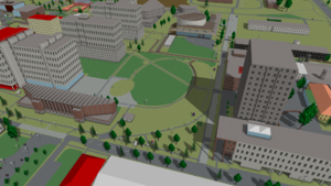
OSM2World is a converter that creates three-dimensional models of the world from OpenStreetMap data. It can be used as a stand-alone tool, on a server or as a library in Java programs.
Can I use it?
Of course! OSM2World is published as Open Source (LGPL) and can be used for free, even in commercial software. Head to the download section. Be warned, though, that OSM2World is still under active development.
How can I contribute?
There are many ways to make OSM2World better: You can contribute code, create art – such as textures and 3d models –, or provide feedback and bug reports. The contact section is just one click away. :)All images on this page are licensed CC-by-SA 2.0 and are based on OpenStreetMap data.